|
| ||||||
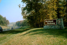
Suitland Parkway Washington, DC 20001 Suitland Parkway is a limited access scenic roadway that was opened during World War II on December 9, 1944, to serve as a rapid transit road between Camp Springs (later renamed Andrews Field) in Prince George's County, Maryland, to Bolling Field Air Force Base, the Pentagon and downtown Washington, D.C. Today the Parkway is a dual lane roadway used by visitors and commuters approaching the nation's capital from the east. The White House frequently uses the Parkway, as well as congressional and military personnel and foreign dignitaries who fly into and out of Andrews Air Force Base (AAFB). The Parkway corridor is often the first image foreign heads of state get of the United States. Suitland Parkway begins in the District of Columbia, and extends 9.35 miles to Maryland Route 4. The Maryland portion of the parkway, about 6 miles in length and on some 610 acres, is under the jurisdiction of National Capital Parks-East, a unit of the National Park Service (NPS). The Parkway is listed on the National Register of Historic Sites. | ||||||
Calculate the distance to the Suitland Parkway by entering your 5-digit zip code:  | ||||||
 Suitland Parkway | ||||||