|
| ||||||
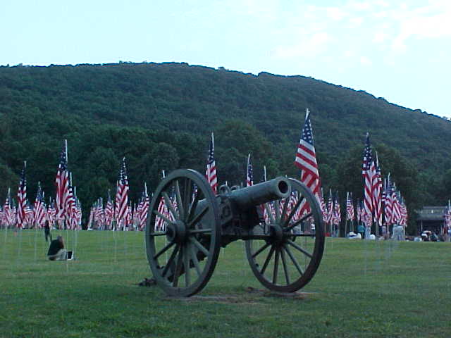
Kennesaw Mountain National Battlefield Park Kennesaw, GA 30152 The name Kennesaw is derived from the Cherokee Indian "Gah-nee-sah" meaning cemetery or burial ground. Kennesaw Mountain Battlefield is a 2,888 acre National Battlefield that preserves a Civil War battleground of the Atlanta Campaign. The battle was fought here from June 18, 1864 until July 2, 1864. Shermans army consisted of 100,000 men, 254 guns and 35,000 horses. Johnstons army had 50,000 men and 187 guns. Over 67,000 soldiers were killed, wounded and captured during the Campaign. There are 3 battlefield areas at the park: In front of the Visitor Center, off Burnt Hickory Road and the main site is located at Cheatham Hill [commonly known as the Dead Angle]. The visitor center provides introductory information about the park and the battle. While walking some of the 17.3 miles of interpretive walking trails you will see historic earthworks, cannon emplacements and various interpretive signs. There are 3 monuments representing groups that fought here. Kennesaw Mountain is 1808 feet above sea level. The Visitor Center is approximately 700 feet above sea level. The hike up is about 1.4 miles on the road and 1.2 mile up the trail. PLEASE help us preserve this park by TAKING ONLY PICTURES AND LEAVING ONLY FOOTPRINTS. The Mission of Kennesaw Mountain National Battlefield: Kennesaw Mountain National Battlefield Park was authorized for protection by the War Department in 1917 and was transferred to the Department of the Interior as a unit of the National Park System in 1933. The 2,888 acre park includes the site of some of the heaviest fighting of the Atlanta Campaign of the Civil War. The park was set aside as an important cultural property dedicated to public inspiration and interpretation of the significant historic events that occurred here. | ||||||
Calculate the distance to the Kennesaw Mountain National Battlefield Park by entering your 5-digit zip code:  | ||||||
Plane - N/A Car - Take I-75 to exit 269 (Barrett Parkway). At the light turn West onto Barrett Parkway. Travel down Barrett Parkway for approximately 3 miles, turn left at the light, onto Old Hwy 41. Turn right at your next light, Stilesboro Rd. The visitor center will be immediately on your left. Brown and white signs located along the roads will guide you as well. Directions from the visitor center to Cheatham Hill are provided in the visitor center at the information desk. Bus - The Cobb County Transit {CCT} stops approximately 3 miles from the visitor center. No other transportation is provided. Public Transportation - Not accessible | ||||||
 Kennesaw Mountain National Battlefield Park | Touring by Auto Hiking Horseback Riding Picnic Area Museum / Visit Wildlife Viewing | |||||