|
| ||||||
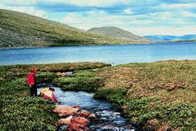
Yukon - Charley Rivers National Preserve Eagle, AK 99738 Located along the Canadian border in central Alaska, the preserve protects 115 miles of the 1,800-mile Yukon River and the entire Charley River basin. Numerous rustic cabins and historic sites are reminders of the importance of the Yukon River during the 1898 gold rush. Paleontological and archeological sites here add much to our knowledge of the environment thousands of years ago. Peregrine falcons nest in the high bluffs overlooking the river, while the rolling hills that make up the preserve are home to an abundant array of wildlife. The Charley, a 100-mile long wild river, is considered by many to be the most spectacular river in Alaska. | ||||||
Calculate the distance to the Yukon - Charley Rivers National Preserve by entering your 5-digit zip code:  | ||||||
Plane - Scheduled air taxis from Fairbanks serve Eagle and Circle, located up river and down river of the preserve, respectively. Car - Yukon-Charley Rivers National Preserve is primarily a wilderness. There is no road access. Two highways serve towns near the Preserve boundaries. The 161-mile Taylor Highway begins at Tetlin Junction on the Alaska Highway and ends at Eagle, 12 miles from the preserve. It is usually open from mid-April to mid-October and is suitable for cars. The Steese Highway is open year round. It begins in Fairbanks and travels 162 miles to Circle, 14 miles from the preserve. In good weather it takes about five hours to drive either of these gravel roads. Check locally about road conditions before setting out. Public Transportation - None. | ||||||
 Yukon - Charley Rivers National Preserve | Boating Camping Fishing Hiking Hunting Museum / Visit Water Sports Winter Sports Wildlife Viewing | |||||